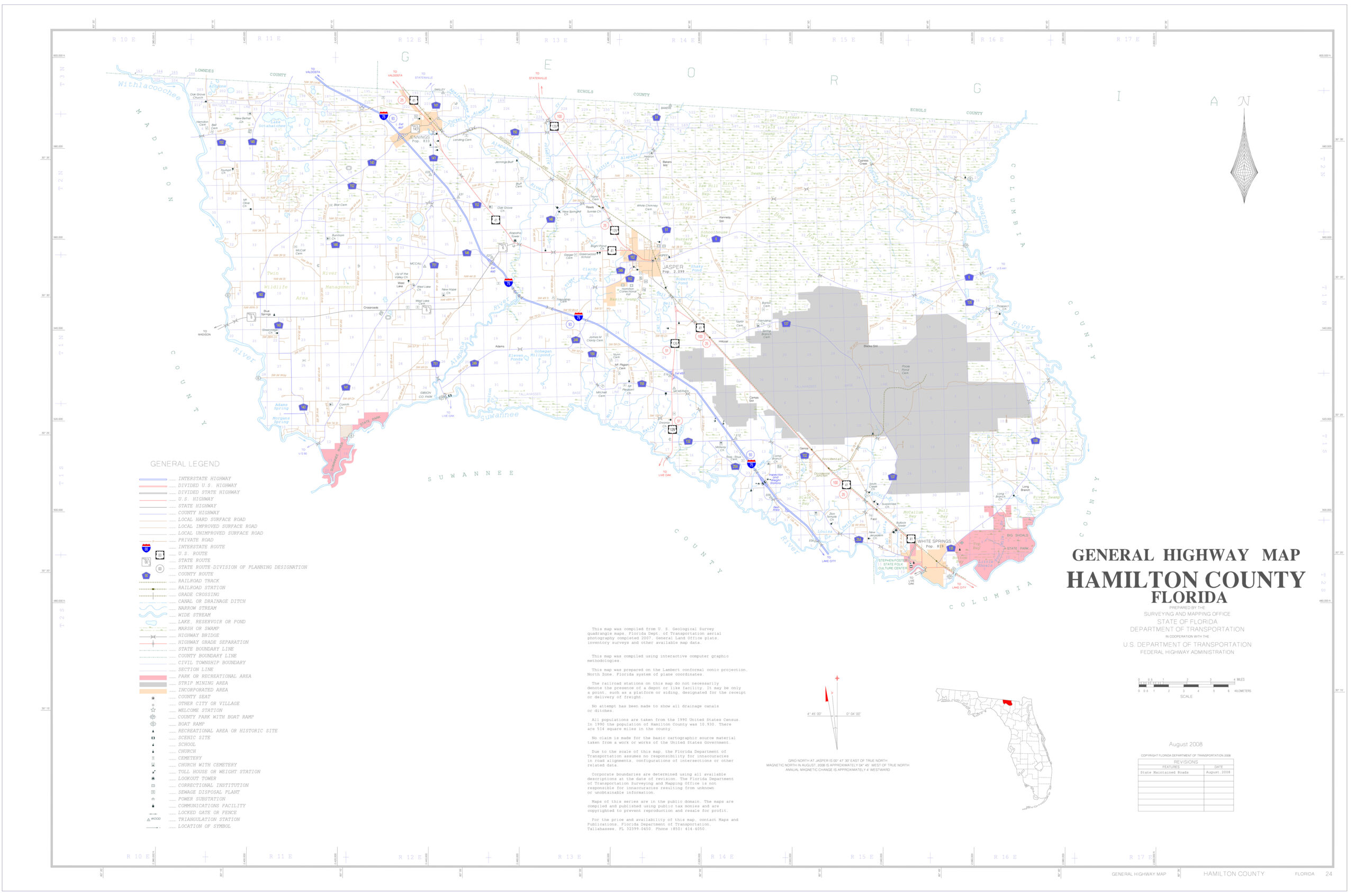
This Hamilton County FL map may be useful to people looking to study, read, and learn a bit more about a particular area, or just wanting to review the country side. These maps often reveal and show more interesting detail than a typical GPS or Google Map view of the area. Things such as streams, creeks, rivers, boat ramps, government owned lands, wetlands, and much more. An invaluable tool for anyone familiarizing themselves with a new area. Check it out and see for yourself!
The Hamilton Co FL map below has information and details about the following roads, highways, towns and villages in the area;
TOWNS / VILLAGES
- Jasper, FL (County Seat)
- Jennings, FL
- White Springs, FL
- Cross Roads, FL
ROADS / HIGHWAYS
- Interstate I75
- US Hwy 41
- US Hwy 129
- State Road 6
- County Road 132
- County Road 137
- County Road 135
- County Road 141
- County Road 143
- County Road 152
- And several others!
If you like history and old historic things, you might find this website that shows historic maps of Hamilton County dating back to the 1800’s interesting as well: Old Hamilton County Fl Maps


